
 Mount Rinjani · UNESCO Global Geopark
Mount Rinjani UNESCO: Your Expert Geopark Guide
Discover the geological wonders, rich biodiversity, and cultural heritage of Mount Rinjani, a UNESCO Global Geopark. We provide in-depth information and funnel enquiries for unforgettable trekking and exploration experiences.
What Rinjani experience are you seeking?
Tell us your interests and we'll guide you to the perfect Rinjani adventure.
You are planning an adventure to one of Indonesia’s most iconic natural landscapes, a journey that promises both challenge and profound reward. Mount Rinjani, a majestic stratovolcano, stands as the second-highest volcano in Indonesia and is the centerpiece of the Rinjani-Lombok UNESCO Global Geopark. This designation, awarded in 2018, recognizes the area’s exceptional geological formations, its rich biodiversity, and the deep cultural connections maintained by local communities. Securing your experience on Mount Rinjani requires precise information and reliable booking strategies to ensure a safe, enjoyable, and environmentally conscious expedition. This comprehensive guide provides expert insights to navigate the permit acquisition process, understand seasonal access limitations, prepare adequately for a multi-day trek, and appreciate the immense natural and cultural value of this extraordinary region.
Embarking on a Rinjani trek is more than just a physical challenge; it is an immersion into a landscape of unparalleled geological wonder and cultural significance. From the challenging ascent to the summit, offering panoramic vistas that stretch across Lombok and beyond, to the serene beauty of Segara Anak lake nestled within the caldera, every step reveals a new facet of this remarkable Geopark. Understanding the regulations and preparing thoroughly are crucial for a respectful and memorable visit. This guide aims to equip you with all the necessary knowledge, transforming your aspirations into a well-executed adventure that honors the spirit of conservation and community engagement central to the Rinjani UNESCO Global Geopark.
Geological Marvels of Rinjani: A Dynamic Landscape
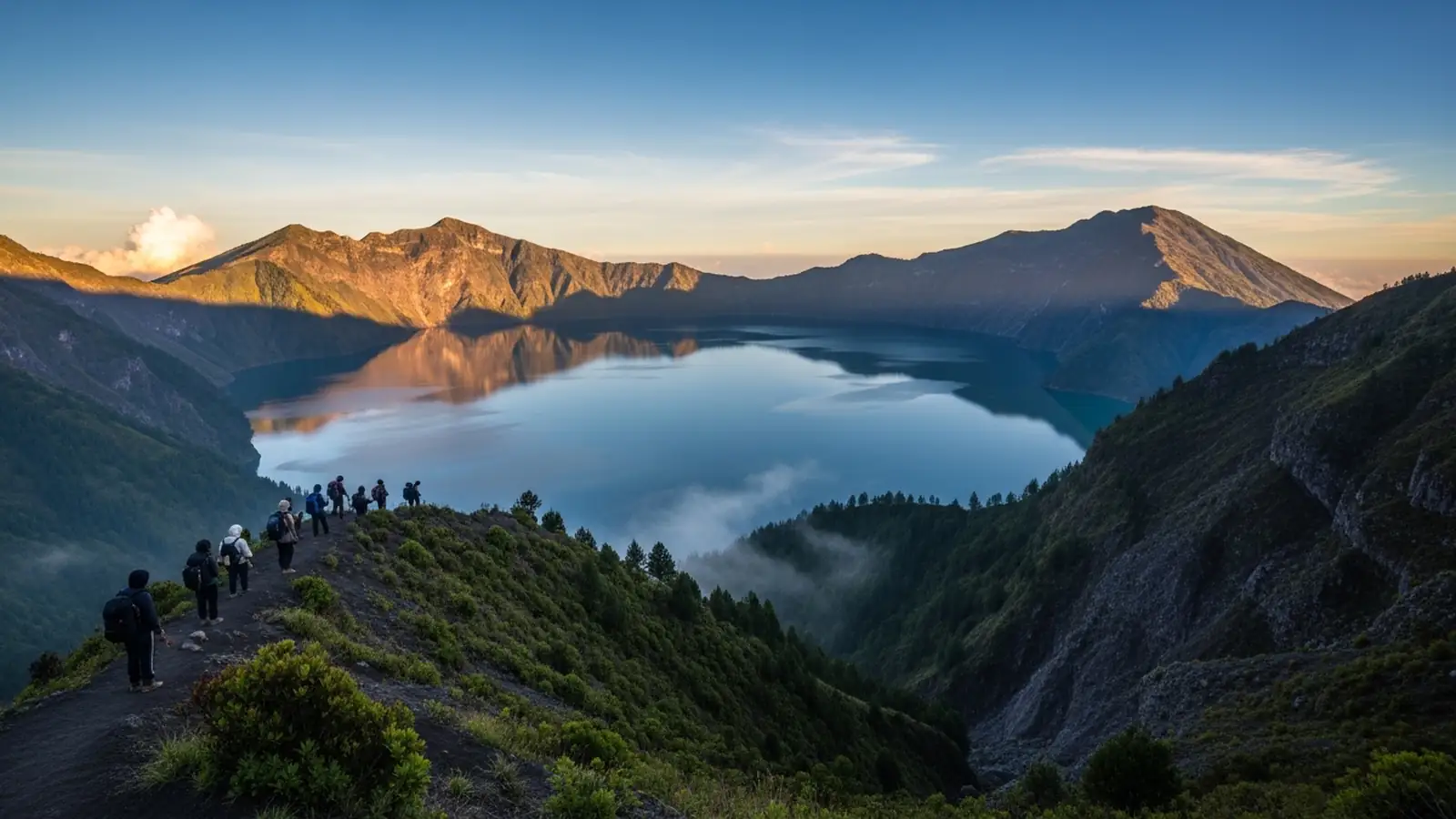
The Rinjani-Lombok UNESCO Global Geopark is dominated by Mount Rinjani, a towering active stratovolcano that has shaped the island of Lombok over millennia. Its most striking geological feature is the massive 50 km² caldera, a vast depression formed after a colossal eruption. Within this caldera lies the crescent-shaped Segara Anak lake, a sacred body of water with a distinct turquoise hue. This lake is not merely a scenic attraction; it is a dynamic geological site, as evidenced by the emergence of a new cone, Gunung Barujari (also known as Anak Rinjani or “Child of Rinjani”), which has grown within the lake itself through a series of eruptions since 1944. The ongoing volcanic activity, though carefully monitored, reminds visitors of the powerful forces at play beneath the earth’s surface.
The Geopark’s geological significance extends beyond the main caldera. It encompasses a range of volcanic formations, including ancient lava flows, pyroclastic deposits, and numerous hot springs, such as those found near Segara Anak lake, believed to possess therapeutic properties. These features offer valuable insights into the Earth’s geodynamic processes and the evolution of volcanic landscapes. The diverse rock types and mineral compositions across the Geopark tell a story of millions of years of geological activity, making it a living laboratory for geoscientists and an educational experience for all who visit. The designation as a UNESCO Global Geopark underscores the global importance of preserving these unique geological formations for future generations to study and appreciate.
Biodiversity and Ecosystems: A Sanctuary of Life
Mount Rinjani and its surrounding areas within the UNESCO Geopark host an extraordinary array of biodiversity, adapting to the varying altitudes and microclimates from the lowlands to the summit. The lower slopes are characterized by tropical rainforests, rich in diverse tree species, epiphytes, and a dense undergrowth that provides habitat for a multitude of creatures. As elevation increases, the vegetation transitions through montane forests to sub-alpine grasslands and scrub, culminating in the sparse, hardy flora found near the crater rim and summit.
This diverse ecosystem supports a significant number of endemic and protected species. Primates such as the Javan langur (Presbytis comata) and the long-tailed macaque (Macaca fascicularis) can often be observed in the forest canopy. The Geopark is also a haven for numerous bird species, including raptors that soar above the caldera, and various smaller forest birds. Unique plant life includes the Rinjani edelweiss (Anaphalis javanica), a protected flower that thrives in the high-altitude volcanic soil. Conservation efforts within the Geopark are crucial for protecting these delicate ecosystems from threats such as deforestation, illegal hunting, and the impacts of climate change. The Geopark status promotes research, environmental education, and sustainable resource management, ensuring that this sanctuary of life remains protected for its intrinsic value and for future generations to experience.
Cultural Significance and Local Community Engagement
Beyond its geological and ecological importance, the Rinjani-Lombok UNESCO Global Geopark holds profound cultural and spiritual significance for the local Sasak people, the indigenous inhabitants of Lombok. Mount Rinjani is revered as a sacred mountain, often referred to as “the abode of the gods.” The Segara Anak lake within the caldera is a particularly holy site, where traditional ceremonies and pilgrimages are regularly conducted. Followers of the Waktu Telu religion, a syncretic belief system unique to Lombok, undertake spiritual journeys to the lake to offer sacrifices and pray for blessings, rain, and a bountiful harvest. These rituals, such as the ‘Pekelem’ ceremony, involve throwing gold, jewelry, and other offerings into the lake, symbolizing a connection to the spiritual realm and a request for prosperity.
The Geopark’s management strongly emphasizes community participation, integrating local knowledge and practices into conservation and tourism initiatives. Sasak communities living around the mountain are actively involved in the trekking industry, serving as guides and porters, sharing their deep understanding of the mountain’s trails, flora, fauna, and cultural stories. This engagement provides economic opportunities while fostering a sense of ownership and responsibility for the Geopark’s preservation among the local population. Visitors are encouraged to engage with these communities, learning about their traditions, sampling local cuisine, and supporting local businesses, thereby contributing directly to the sustainable development goals of the Rinjani-Lombok UNESCO Global Geopark.
Navigating Rinjani’s Trekking Routes: Planning Your Ascent
Mount Rinjani offers several trekking routes, each presenting distinct challenges and rewards, catering to different levels of experience and desired durations. The two primary starting points are Sembalun and Senaru, both located on the slopes of the mountain. The Sembalun route, typically used for the summit ascent, begins at a higher altitude, making the initial stages less steep but leading to a more challenging final push to the crater rim and then to the 3,726-meter summit. This route often forms part of a 3-day, 2-night or 4-day, 3-night trek, allowing for summit attempts and descent to Segara Anak lake. Key camps include Pos 1, Pos 2, Pos 3, and Pelawangan Sembalun, which is the final camp before the arduous pre-dawn summit climb.
The Senaru route, starting at a lower elevation, is generally considered more scenic in its initial stages, winding through dense tropical rainforests. It is commonly used for shorter treks (2-day, 1-night) that reach the Senaru crater rim, offering magnificent views of Segara Anak lake and Gunung Barujari, but typically without attempting the main summit. Longer treks can combine both routes, ascending via Sembalun and descending via Senaru, providing a comprehensive experience of the Geopark’s diverse landscapes. Crucial points on the Senaru route include Pos 1, Pos 2, Pos 3, and Pelawangan Senaru. Regardless of the chosen path, all routes demand a good level of physical fitness, proper acclimatization, and the guidance of experienced local trekking organizers to ensure safety and adherence to Geopark regulations.
Permits and Booking: Essential Pre-Trip Arrangements
Securing your permit to trek Mount Rinjani is a critical step that requires careful planning and execution. As a UNESCO Global Geopark, access is regulated to manage visitor numbers, protect the environment, and ensure safety. All trekkers must register and obtain an entry permit through authorized channels. The Rinjani National Park office implemented an online booking system, which is the primary method for permit acquisition. This system helps in monitoring visitor flow and ensures that trekkers are accompanied by licensed guides and porters, a mandatory requirement for all expeditions.
When booking, you will typically need to provide personal details, passport information, and specify your intended trekking dates and route. It is highly recommended to book your permit well in advance, especially during peak season (April to October), as daily quotas are enforced. Reputable local trekking operators are usually responsible for handling the permit process on behalf of their clients, simplifying the procedure. They will also ensure that your group adheres to park regulations, including waste management protocols and designated camping areas. Be wary of unauthorized individuals offering permits, as these may be fraudulent and could lead to denied entry or other complications. Always confirm that your chosen operator is officially registered with the Rinjani National Park authorities to guarantee a legitimate and hassle-free experience.
Seasonal Access and Weather Considerations
Understanding the seasonal variations and their impact on trekking conditions is paramount for a successful Rinjani expedition. The Mount Rinjani National Park generally operates with two distinct seasons: the dry season and the rainy season. The dry season, typically spanning from April to October, is considered the optimal period for trekking. During these months, the weather is generally clear and sunny, offering stable trail conditions and excellent visibility for panoramic views. Temperatures at higher altitudes can still be cool, especially at night and during early morning summit pushes, necessitating appropriate layering of clothing.
Conversely, the rainy season, from November to March, brings heavy rainfall, increased humidity, and a higher risk of landslides and flash floods. Due to these hazardous conditions, the Rinjani National Park is usually closed to all trekking activities during this period for safety reasons and to allow the ecosystem to recover. Annual closures can vary slightly, so it is essential to check the official Rinjani National Park website or consult with authorized trekking operators for the most up-to-date information regarding opening and closing dates. Attempting to trek during the rainy season, even if parts of the park are unofficially accessible, is strongly discouraged due to the extreme dangers involved. Planning your visit during the